

Why the Southwest Feels Like a Different Planet
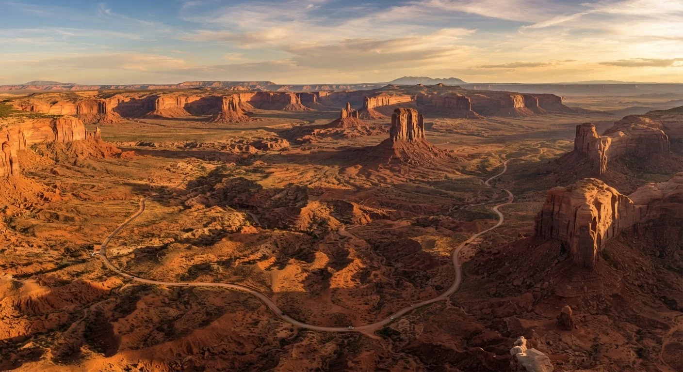
Travelers often step out of their cars somewhere along a Utah highway or a New Mexico mesa and feel a genuine disorientation - not from heat or altitude, but from the sheer visual strangeness of the land. The American Southwest doesn't gradually introduce itself. It announces itself in burnt oranges, rust reds, and pale lavenders stacked in impossible horizontal bands.
That feeling has a foundation. The Colorado Plateau, which anchors much of the region, is one of the most geologically intact landmasses in North America. Unlike coastlines reshaped by constant erosion or Midwest plains buried under glacial deposits, the plateau has remained relatively stable for hundreds of millions of years - which is precisely why its ancient layers are still visible, legible, and stunning. Coming to the Southwest with even a basic understanding of what you're looking at transforms the experience from sightseeing into something closer to reading.
Reading the Geology: What the Colors and Layers Actually Mean
The banded cliffs that make places like Zion Canyon, Monument Valley, and the Painted Desert so visually arresting are sedimentary rock formations - layers of sand, silt, and organic material compressed over time. Each band represents a different geological era and environment: ancient desert dunes, shallow sea floors, tropical floodplains. The famous red and orange tones come largely from iron oxide, essentially rust, present in sandstone. Whiter or cream-colored layers often indicate limestone, formed in marine environments. Darker basaltic rock signals volcanic activity - common in parts of New Mexico.
Arches, hoodoos, and slot canyons form through a slower, ongoing process: water infiltrates cracks in rock, freezes and expands in cooler months, and gradually widens fractures over millennia. Wind carries abrasive particles that sculpt softer stone into fins and spires. Seeing a formation like the sandstone arches of Arches National Park isn't just admiring scenery - it's watching geology in its middle chapters.
When visiting slot canyons in Arizona or Utah, always check the weather upstream - not just at your location. Flash floods can funnel through canyon systems with almost no local warning.
Flash flood deaths in slot canyons frequently involve visitors who saw blue skies locally but had no knowledge of storm activity miles away in a watershed above them.
In New Mexico, always ask whether a dish comes with red or green chile - or both (called 'Christmas'). This isn't garnish; it's central to the cuisine and varies dramatically in heat level by season and source.
New Mexican chile culture is deeply specific and locally meaningful. Understanding it helps travelers engage more genuinely with the food tradition rather than treating it as an afterthought.
For travelers interested in exploring lesser-celebrated formations, parks beyond the famous marquee names offer comparable drama with significantly smaller crowds.
Climate Realities Every Traveler Should Know
The word "desert" can be misleading. The Southwest encompasses high-elevation forests, low-lying scrubland, and everything between. Flagstaff, Arizona sits above 6,900 feet and receives regular winter snowfall. Phoenix, roughly two hours south, regularly records summer temperatures exceeding 110°F. Traveler preparation must match the specific terrain, not a generic idea of desert climate.
Summer monsoon season - typically mid-June through September in Arizona and New Mexico - brings sudden, intense afternoon thunderstorms. Flash floods in canyon systems can develop with terrifying speed from rainfall miles away. Slot canyons, dry washes, and low-water crossings are especially dangerous during this period. Meanwhile, spring and fall are generally regarded as the most temperate seasons across most of the region, though mountain areas can see cold snaps into May and October.
Flash Floods and Heat: Underestimated Risks
The Southwest's most dangerous conditions are often invisible at first glance. Flash floods can fill dry canyon beds within minutes during monsoon season, even under a clear sky. Extreme heat - especially at lower elevations in summer - can cause serious health complications rapidly. Always research current conditions, carry ample water, and file a loose itinerary with someone before heading into remote terrain.
Altitude sickness is a genuine concern when driving from desert lowlands to mountain elevations in a single day. Stay hydrated, ascend gradually where possible, and recognize symptoms - headache, nausea, fatigue - as signals to rest, not push through.
Cultural Depth: Indigenous Nations, Spanish Colonialism, and the Modern Mix
The Southwest is home to dozens of federally recognized Indigenous nations, including the Navajo Nation - the largest by land area in the United States - as well as the Hopi, Zuni, and numerous Pueblo peoples of New Mexico. These are not historical communities; they are contemporary sovereign nations with governments, economies, and living cultural traditions. Visitors entering tribal lands are guests, and many nations require separate entry permits or restrict photography at ceremonial sites.
Spanish colonial influence, stretching from the 16th century forward, shaped architecture, place names, and foodways throughout the region. New Mexico's adobe missions, the grid layout of many Southwestern towns, and the prevalence of chile-forward cuisine all carry this lineage. Understanding that what's often labeled broadly as "Southwestern food" is actually an intricate blend of Native, Spanish colonial, Mexican, and Anglo-American traditions makes every meal more interesting. The distinction between Tex-Mex and interior Mexican cooking becomes especially relevant here, where New Mexican cuisine is its own distinct tradition - centered on Hatch green and red chile, not the same thing as either.
For a deeper look at how regional American food traditions layer together, the first-timer's map to American regional cuisines provides useful context.
Where to Focus: Arizona, Utah, and New Mexico at a Glance
Arizona anchors the southwestern corner of the region. Its contrasts are extreme: the Grand Canyon in the north, the Sonoran Desert's saguaro forests in the south, the red rocks of Sedona in the center. The state rewards explorers willing to move between elevations.
Utah holds a remarkable concentration of canyon country within its southern half alone - five national parks within roughly 200 miles of each other (Zion, Bryce Canyon, Capitol Reef, Canyonlands, and Arches). The terrain is among the most photogenic on earth, and the geology is exceptionally well-preserved.
New Mexico is the region's cultural and artistic anchor. Santa Fe, one of the oldest continuously inhabited cities in North America, blends Indigenous Pueblo architecture with Spanish colonial design and a thriving contemporary arts scene. White Sands National Park, with its gypsum dunes, offers an almost surreal landscape unlike anything else in the Southwest.
Planning a multi-state loop is one of the most rewarding ways to experience the region. If you're weighing logistics, the trade-offs between road tripping versus flying are worth thinking through before you commit to an itinerary.
Traveling Respectfully and Safely in the Desert
A few guiding principles go a long way in the Southwest. Carry significantly more water than you think you'll need - a common recommendation is at least one liter per hour of active hiking in warm conditions, though individual needs vary. Start hikes early to avoid peak afternoon heat. Never leave pets in vehicles. Stick to marked trails in fragile environments like cryptobiotic soil crust, which appears as a dark, lumpy crust on desert ground and can take decades to recover from a single footstep.
When visiting tribal lands, follow posted rules, purchase permits where required, and resist the urge to photograph people, ceremonies, or sacred sites without explicit permission. Buying directly from Indigenous artists and vendors at markets and roadside stands supports communities far more meaningfully than purchasing mass-produced imitations elsewhere.
Entry requirements, road conditions, and safety advisories for tribal lands and national parks can change. Always verify current conditions with official park service resources and relevant tribal offices before your trip - this article provides general context, not real-time guidance.
Travel conditions, entry requirements, and safety recommendations across tribal lands and federal parks can change. Verify current rules and advisories through official government and tribal sources before you travel.
The content on this site is provided for informational purposes only and should not be considered a substitute for professional advice. While we strive to provide accurate and up-to-date information, we make no guarantees regarding its completeness or accuracy. Always consult a qualified professional for advice specific to your circumstances before making any decisions.